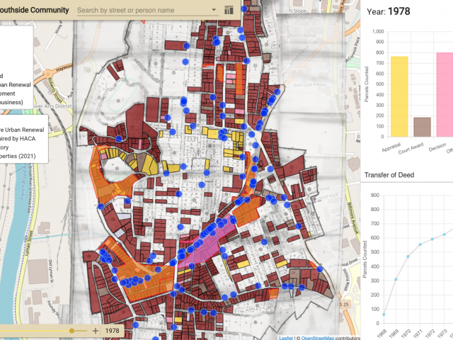
This project aims to build a map-based platform that presents historical documents of the nation-wide, urban renewal project in 1960's and 70's and to provide easy-to-use interfaces that can be used by former residents, archivists, researchers, and citizens. Ultimately, this platform aims to reconstruct a virtual neighborhood where people can share their memories by creating social networks of former residents. This project is three-fold: (1) exploring map-based techniques to archive and visualize historical data so to provide diverse access points to the collection, (2) providing structured data by integrating various kinds of databases and navigation tools, and (3) studying value-sensitive design of historically sensitive data platforms in the context of local communities and social justice through interviewing diverse stakeholders. For the map-based techniques, we are currently developing digitization methods using QGIS, ArcGIS, and other geographical/graphical tools to better present old maps and associated information on the online map. Also, user-centered UI design methods are used to develop the user-friendly interfaces.
* On June 24th, 2021, our team of researchers, community members, and experts held a Stage 1 website launch event virtually. The launching event video available at: https://www.youtube.com/watch?v=R4hPRMwlbcU
* The website has been built as a storytelling platform: https://urbanrenewalimpact.org
* I have led a group of undergraduate and graduate students for this project to curate the documents and to design and prototype a map-based system since 2016.
* This work was presented at the MARAC conference (Fall 2016), the Digital Curation and the Local Community workshop (Spring 2017), IEEE Big Data (Winter 2017), and iConference (Spring 2018).
* Our team received the Research Improvement Grant (RIG-II) from the UMD iSchool for this project in 2017.
* 3/20/2023 Asheville Reparation Commission Meeting (demonstrating urban renewal impact): https://www.youtube.com/watch?v=BLrpQLU_buE