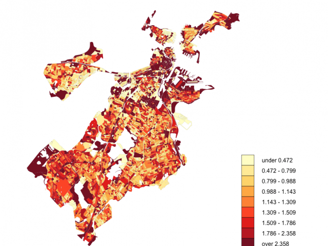
This research will develop a foundational tool for understanding how civic technologies are used and how information inequalities manifest in a city. User data from new civic technologies that reveal inequalities in the information environments of citizens has only recently become available. Since a large portion of data is demographically or geospatially biased due to varying human-data relationships, computational social scientists have used data modeling and algorithmic techniques to adjust the data and remove biases during data-processing. However, this approach limits our understanding of how and why biased information is created, and our ability to address urban information inequalities and biased data-creation. Consequently, as cities transition to e-government enabled by information and communication technology, they may project the inequities of the past into the smart cities of the future, so a fresh approach is needed. This innovative research analyzes and visualizes data from Boston's 311 system for reporting non-emergency issues to the city government, using computational and qualitative approaches to identify, categorize, and understand the kinds of information disparities that are becoming institutionalized by crowdsourced municipal systems, inhibiting smart city transitions, and perpetuating information deserts. For Boston and its citizens, this research could improve both the function and the equity of the city's 311 system. The resulting insights and tools could also inform other cities' implementation of smart city technologies, identify potential distortions in existing urban datasets, and surface potential corrections that could improve decision making and equitable delivery of services for all residents.
The research will be performed in three phases. First, six years of civic, census, and geospatial data will be combined with interviews with users, then analyzed to discover the socio-technical dimensions of "information deserts," which are conceptual and physical spaces where local information is poorly embedded in diverse infrastructures and/or less available than in other areas of a city. This research will develop a conceptual model to determine where and how information deserts are located, identify a typology of information deserts based on related community features; and, assess relationships between information deserts and major demographic and geospatial features of data biases. Second, the research team will perform semi-structured interviews with civic stakeholders to gather user requirements for a visual analytics tool as well as to validate the ground truths for the initial models. Based on this, a visual analytics tool will be created to show different types of information deserts, their causes, and anticipated results. Third, through an iterative process, the research team will conduct participatory modeling activities with municipality officials and relevant stakeholders to refine the computational models with local contextual information. Also, the usability of the visual analytics tool will be improved with additional user studies. The resulting conceptual and computational models of information deserts will support a refined visual analytics tool that displays information deserts and their characteristics.
* I am grateful that this research was accepted to NSF IIS' CHS Program in collaboration with UMD (Dr. Susan Winter, PI), Arizona State University (Dr. Erik Johnston, PI, and Dr. John Harlow, Non-PI Senior Personnel) and Emerson College (Dr. Eric Gordon, PI) (Award #: 1816763)
* I lead-authored this proposal with PIs and Dr. Harlow. This project will make use of a Theory of Local Information Landscapes (LIL theory) and the information deserts framework, which appears in JASIST.